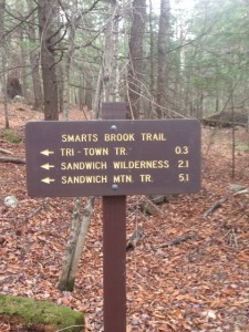
I did these two peaks as a trail run with a bike spotted up the road at the beginning of the Sandwich Mtn trail and Drakes Brook trail. This was recommended to me by one of my professors and I have to say it was a great experience, mixing the trail run with a bike ride was a lot of fun. For the beginning of this route you park at the Smarts Brook trail parking lot. Here in the parking lot there are trail signs, which you should look at before taking off on your adventure because there are many smaller trails that break off of the Smarts Brook trail, used primarily for walking and cross country skiing in the winter. Starting on the Smarts Brook trail you will see this first sign by the parking lot. The beginning of this trail is an easy trail as it use to be a logging road. As you follow the trail you will also follow the Smarts Brook, which you will have to cross over a few times. The trail gets both muddy and wet at points so bring a waterproof pair of hiking boots or an extra pair of socks (unless you don’t mind wet feet). Also I would not recommend this trail after heavy rain. Once you have gone 2.1 miles you reach the Sandwich Wilderness where the trail starts to change, it turns into a narrow trail through a beautiful forest. On the trail the footing is good for the most part and it is mellow in elevation gain for most of the time with the exception of 3-4 steeper areas. At the end of this trail you come to an intersection, you want to go left here towards Jennings Peak. The peak for the trail in only about 4/10ths of a mile up the trail on your left. Once at the top the mountain rewards you with some spectacular views of the east and southwest.

Sandwich Dome far right
Come down from the side trail of Jennings Peak and continue left on the trail and you come to a 3 way intersection,
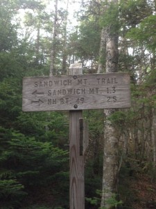
here you want to follow the signs to RT.49. This will bring you to the parking lot where either your car or bike are. I followed the sign that said:” –> RT.49 2.5 mi.” This brings you to Noon peak and down the Sandwich Mtn. trail. It is a steep trail and not the best for running. However, you can take the Drakes Brook trail down, which I recommend, especially if you’re jogging. It is a little longer, but much more gradual. This trail totals 8.8 miles and brings you to the parking lot where I left my bike. I hopped on and started riding down RT.49, which has wide shoulders to ride on and not much traffic. It follows the Mad River down to the Smarts Brook parking lot. This bike ride is almost all slightly downhill and in almost exactly 5 miles (4.9 miles) you are back where you started.
Getting There
Start on I-93 and take exit 27 off onto Rt.3. Continue North on Rt.3 for about 2.3 mile s until you come to the junction for Rt.49 on your right. Continue on Rt.49 for 6.1 miles and you will see the sign for the Smarts Brook parking lot on your right.
FYI
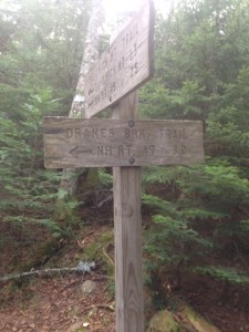
When starting this trail make sure to look at the maps in the parking lot because there are a lot of other trails that intersect with the Smarts Brook trail in the beginning. Also when running or hiking on the Smarts brook trail be prepared to get your feet wet, parts of this trail are very wet and muddy. Once you are coming down from Jennings Peak and go left you come to the 3 way intersection.

At this intersection you have two options, one is to go down the Sandwich Mtn. trail (picture on the right), which is the steeper of the two trails. Your other option that I recommend is going down the Drakes Brook trail (picture on the left) because it is not as steep. Lastly just lock your back at the other parking lot so it is there when you are. The hike/jog is about 9 miles (8.8 miles) and the bike ride is 5 miles. Get out, be active and enjoy the loop!!

