It was nearing the end of October and another month’s rent was going to be due. I was not happy with the commute I was taking everyday to my University so I had been looking for apartments closer campus, however, I could not find one that me suited me. I started to get the idea of camping in the woods by my university. I wondered how can I live out of a tent while still going to classes? Where would I make my food and keep my belongings? Is it even legal? Soon this idea started to build on itself just like all ideas do. I looked around the woods and found a spot that was close enough for me to walk to my classes. Then I thought I could use the on campus kitchen to make and keep my food in. When it came to my belongings I would keep them spread out in different lockers, friends houses, in my car, and in my tent. As for my last question I figured I would have my tent hidden so no one would know and that question wouldn’t have to be answered. I started to think I was ready to make this change.
Uncertain and worried that this new experience might not go as planned I asked myself what’s the worst that can happen? The answer I got was that I fail. I know Failure isn’t all that bad, it is necessary and if we learn from it, it’s a good thing. So I went for it;the day before my next month’s rent was due I moved out. I went down the trail, into the woods and cleared a spot where I would sent my tent up. My next stop was to get the supplies I didn’t have and needed (camo tarps, lantern, organization bins and a pee bottle). I got my campsite set up and was pleased with it except for the fact you could see it from the trail. So I started building a wall out of branches, vines and dead plants. Once this was complete my campsite was blended in. Now I needed to get my organization down.
I put almost all my clothes in bins in my tent. My school books, shoes, more clothes and other miscellaneous stuff I kepted in my trunk. Towels, bathing suits, hygiene products, and dirty clothes I kept in the universities lockers. My tv, mini fridge, speakers and a big duffel bag full of stuff I left at a friends house. I was organized and feeling confident about this adventure.
The first few nights in the tent were cold, but I started to learn to bundle up more at night. Then I was noticing a lot of condensation in my tent, so I would keep the door open to let my breathe circulate. The first week I was learning and getting use to it, making adjustments where they were needed. I never really missed a meal I would do all my shopping at the grocery store, storing my food at the on campus kitchen and making it there as well. This was a great experience because I was meeting people on campus that I would never have before; people coming and going around the kitchen. A very nice lady, Sarah, had her office across the hall so every time I went in we would chat and have some good conversations about each other and our days. This was going on for a couple of weeks and it seemed like it could last a while even though the weather was getting colder since it was November.
Then one day I pulled into where I usually park my car and there were crowds of people including police and the search and rescue teams. I had no idea why and went back to my tent to check things out. As I was getting back there the K-9 unit came out of the woods where my tent was. They were looking for a missing student who was last seen by the woods near my tent. I assured them that the tent was mine and not the missing students and they barely questioned me, I assumed they had bigger fish to fry. Everything went on as normal and I kept sleeping in my tent, going to classes, and eating 3 meals a day.
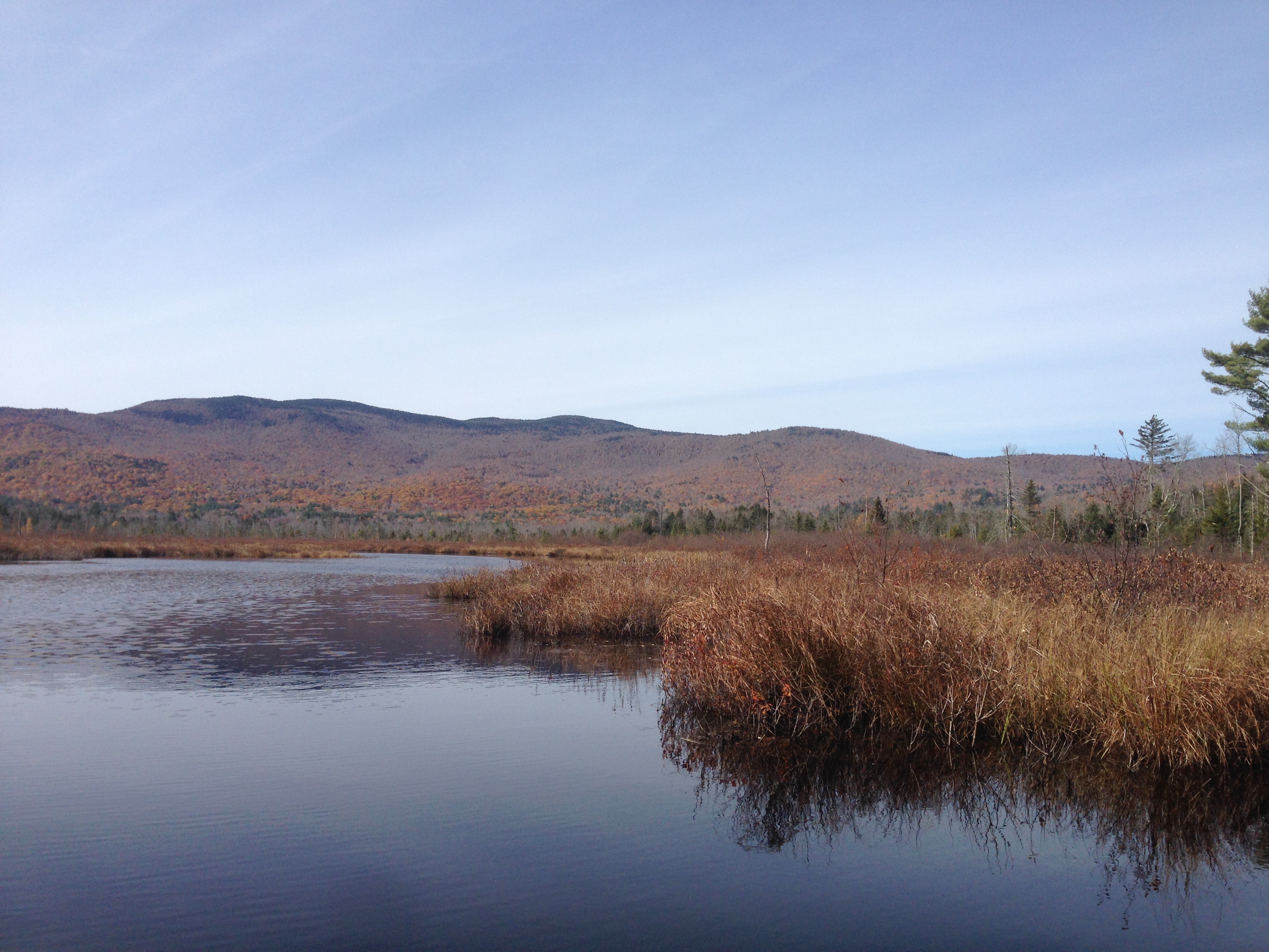
The beginning to the end of this experience started one Friday night. It had rained hard on Friday night and Saturday morning when I arose I noticed the river I was sleeping next to had risen so much it was going over the river banks. I pulled my tent uphill bringing it out of it’s hiding spot. In about 20 minutes there was a foot of water where my tent was and I had to stay with a friend that night because of all the flooding. The next day before my hike I went to my car to grab my microspikes, next to my car was a cop car and I knew exactly why they were there. I ran back into the woods and to no surprise a cop and another man were checking out my tent. I called out to them and told them that it was my tent. I explained my situation to them to which they were very understanding. I told them about how it had flooded, that I was just out there for the experience and they thought it was cool. However, they did not know whose property I was on so they said I probably could not stay there. I told them I would be out in a couple of days. Although what happened next made me leave sooner. That night when I arrived back at my campsite I noticed my tent was not there, but some of my clothes and my sleeping pad my were strewed across on the ground. I saw my tent upside down on the river bank with all my clothes in it. Someone had come by and tried to throw my tent with all my clothes in the river! Fortunately, they were unsuccessful because of the thick bushes on the bank stopped it from going in. I grabbed my stuffed together and organized it for one more night of sleeping. When morning came I packed up in the rain and headed out. I could not take the chance of someone coming back again and maybe successfully throwing my stuff in the river.
I couldn’t chance staying there now that people knew where my spot was. It was good while lasted, but all things come to an end, both good and bad. When I first thought about taking on this challenge I didn’t think I would actually do it, it was just an idea I was playing around with in my head. However, I can’t imagine not taking it now. This change that I made not only in my location, but also in my lifestyle for 22 days was an exciting experience that made each of my days a little different than last. I proved to myself that if I could imagine something I could do it, giving myself a new sense of confidence. I was rewarded almost every night before I went to bed by seeing the stars while brushing my teeth, making me realize how much the little things matter even in a universe so vast. I was scared at first of taking this chance into the unknown, but when I embraced this change the fear went away and personal development took its place.
Adventures like this where you make a volitional change are important because you are knowingly going into the unknown and most people are scared of what they don’t know; just like people who say they are scared of the dark, these people do not actually fear the dark itself they are scared of what they can’t see in the darkness, the unknown. However, having this fear is many times necessary for self improvement. Without fear you cannot have courage, courage is the ability to do something in the face of fear, it is your triumph over fear. Wielding courage Strengthens us, you become stronger and more confident with every fear you face and overcome. You become a new person with every courageous act you do, taking fear out of the world and putting bravery in its place.
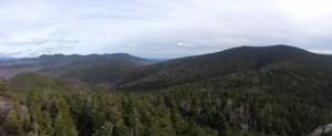
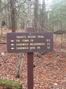 first sign by the parking lot. The beginning of this trail is an easy trail as it use to be a logging road. As you follow the trail you will also follow the Smarts Brook, which you will have to cross over a few times. The trail gets both muddy and wet at points so bring a waterproof pair of hiking boots or an extra pair of socks (unless you don’t mind wet feet). Also I would not recommend this trail after heavy rain. Once you have gone 2.1 miles you reach the Sandwich Wilderness where the trail starts to change, it turns into a narrow trail through a beautiful forest. On the trail the footing is good for the most part and it is mellow in elevation gain for most of the time with the exception of 3-4 steeper areas. At the end of this trail you come to an intersection, you want to go left here towards Jennings Peak. The peak for the trail in only about 4/10ths of a mile up the trail on your left. Once at the top the mountain rewards you with some spectacular views of the east and southwest.

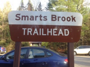 s until you come to the junction for Rt.49 on your right. Continue on Rt.49 for 6.1 miles and you will see the sign for the Smarts Brook parking lot on your right.