Mt. Moosilauke (4,802ft) and South Peak (4,523 ft)

An amazing hike, one of my favorites that will give you great views for not too much of a climb. I started this hike up

IMG_4016 (1)

White trail markers to follow

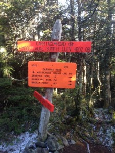
the glencliff trail. It starts off real pretty and easy taking you through a couple of fields where you can look up and see the mountains you’re about to climb hovering over you. In the first .4 miles the trail enters the forest and then splits, stay left on the glenncliff trail. following the white trail markers for 2.6 miles (which has really only one steep section the whole way) until you reach the South Peak junction. Here you will come to orange trail signs, make sure you follow the one that says “Southpeak .2 miles”. Once yIMG_4065ou take this trail you will have spectacular 360 degree views at the peak and will be able to see the ridge that goes right up to Mt. Moosilauke. This first peak is an ideal spot for a break or just taking in the sights. Then go back down to the junction and follow the orange sign (pictured right) that says Moosilauke summit .9 miles. The ridge over to Moosilauke is so nice and flat and you may have the urge to run it! Once you start ascending again get your cameras ready because you will be entering the alpine zone (above tree line). After the total 3.9 mile hike (4.1 with south peak) out you have reached the top of Moosilauke and boy are the views something else! On the day I went we were above the clouds and spent as much time as we could up there. So much that we couldn’t do the loop we wanted to so we went back down the way we came. Once you’ve finished your roughly 8 miles (6.5 hours) of hiking for the day you will be back on the old logging road you started on and then back to the parking lot, where hopefully your car still is!
IMG_4047 (1)

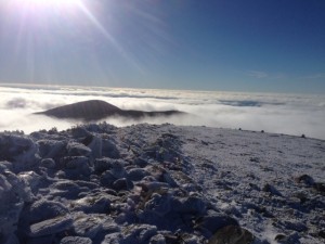
Views from the top of Moosilauke

FYI

  • This hike does not have a whole lot to it. The biggest thing is be prepared! Weather can turn quickly up in the mountains and especially in the alpine zone.
  • If the weather turns and you are not prepared for it do not go into the alpine zone because the conditions will only get more extreme here.
  • Make sure you have enough food and water for the 8 mile hike (always better to be over prepared)
  • Follow the signs and you’ll be good!

Getting There

Getting to the trailhead in Glencliff, NH is pretty straight forward, however the first turn off of  Rt. 25 onto High St. can be easily missed. Starting your way to the trailhead take exit 26 off of I-93 onto Rt. 25 West, stay on this route taking the first exit on the rotary you come to. After the rotary you stay on 25 West (merges with 118 for a bit) for 20

IMG_4070

Parking lot sign for trailhead

miles until you see High st (Glencliff,NH) on your right. Stay on High St. for about 1.2 miles until you see the parking lot on your right. FYI if you cross the town line past Glencliff you have gone too far and missed the High st. tuIMG_4066rn. Also the parking lot is right across from a healthcare facility sign (pictured right)
Tenney Mountain (2,349 ft)


Today I wanted to do a fairly easy, short hike near me, so I decided on Tenney mountain. This ski resort mountain has been closed for the past few years, but is in the stages of re-opening for the 2015-2016 season. This makes the hiking a bit easier since the trails are cleared just like on any other ski mountain. There are ski maps around the base

IMG_4005

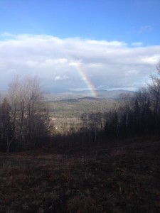
Condition of the trails with a nice views of the land and rainbow.

of the mountain that you can look at before starting your hike to pick the route you want. However, if you are looking for a more gradual and a bit longer of a hike there is a dirt road that winds up to the top. Either way the trails are cleared with good footing and nice views the whole way up; although it can get muddy and wet so be prepared. Once at the top you are greeted with a wide northeastern view. You will be able to see the windmills on the ridge to your north and a large amount of other mountains in the Plymouth area. The top is a great place to be this time of year since there is almost no one up there (I saw no one the whole time). Also you can either sit on the chair lift or the other chairs they have up there, which are great for unwinding, reflecting or  maybe just have a snack.

IMG_4013

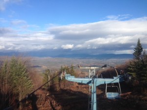
Views at the summit on top of the chair lift.

Once you’re ready to come down you can take any route you prefer; since all the trails lead to the resort you don’t need  to worry much about getting lost.


FYI

  • Look at the maps on the base before you get on the trails. You will be able to tell the steepness of the trail by its difficulty rating on the ski map.
  • You can still come and do this hike mid-winter just know the trails will have skiers on them so wear your snowshoes or ski skins and stay on the side of the trail.

Getting There

From interstate 93 take exit 26 onto Rt. 25 headed West. Stay on this route until you come to a big rotary you will take your second exit on this rotary, which brings you onto route 3A. Drive on 3A for about 1.8 miles and the Tenney Mountain Resort you will be off of it on your right hand side. There is a big sign that you can’t miss. Pull in, drive up and you will have arrived at your destination. Hop out of your vehicle ready for a great local hike!

IMG_4015

Sign off of Route 3A where you will pull into.

Pemigewasset River (Livermore to Plymouth)

IMG_3972

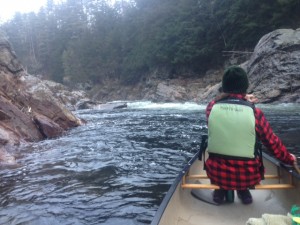
Hanging out in an eddy at Livermore right before doing a peel out.

With this indian summer we’ve been having this winter in New Hampshire I decided to take the canoe out after hitting the slopes at Loon Mountain this morning. That doesn’t happen very often. So I took advantage of this nice weather and decided to go down the Pemigewasset River. My friend Becky and I started at Livermore Falls in Campton, NH and ended up right behind the courthouse in Plymouth, NH. It was a fun 1.5-2 mile stretch of the river where you go over a few rapids mainly all class 1 with maybe an EASY class 2, all depending on the CFS that is. Today the CFS was 846 this means 846 square foot cubes of water are moving past a single point in one second. Make sure to check the CFS before you go out on any moving body of water. With that being said this part of the river is doable for a beginner to novice paddler at the CFS we had today (give or take some). When starting you can park in the dirt parking lot of Livermore Falls, next portage your canoe down to the beach where you will see an abandoned bridge and this is where you put in. You will be right above the first rapid and you are now at the start of your adventure, which shouldn’t take you more than 45 min. You know you are close to the end when you go under the I-93 bridge in Plymouth, this is only about 1/3 of a mile to the end. Then once you get to the courthouse there will be a boat launch to take your canoe easily out. Grab your second car that you parked by the courthouse, there is 25 cents an hour parking or you can go right past the senior center where there is free parking in the dirt parking lot. Strap your canoe up, go get your other car and you have completed yet another adventure! If you have done this part of the river good for you, it is serene, wild and beautiful, all in one!

FYI

  • Check the CFS
  • Too little CFS and the river will be too shallow to paddle in some parts
  • The higher the CFS the more water will be flowing, which means the rapids will be more difficult
  • Wear a PFD
  • Park one car at the beginning and one at the end (unless you have another plan)
  • You can portage around any of the rapids you don’t feel comfortable going over
  • You can make this trip longer if you choose (both distance and time)

Getting There

To get to Livermore Falls ,travelling on I-93 take exit 25 onto Holderness Rd. (175A). Then in one mile you take a left onto Rt.175 , travel on this road for about 1.8 miles until you see Livermore Rd. on your left. Take this left and not far up you will see a dirt parking lot on your left where you can park your vehicle. There is gate that you will portage your canoe past and down to the beach.

Getting to the courthouse or senior center near where you will park your second vehicle take exit 25 off I-93 as well. Go right onto Holderness Rd. (Rt.175A) and take the first left right before the rotary onto Green st. All the way at the end is the free parking in the dirt parking lot. Between the courthouse and the dirt parking lot you can pay to park for 25 cents an hour.