About a mile in on flat and easy terrain the sun began to hit the top of the trees of the forest I was in. As this was happening I heard the birds begin to chirp, it was if they were waking up and wishing all the living things around a good morning. After pausing and taking in the experience I kept hiking/jogging to the first junction of the hike (1.8 miles in). Here there are signs from the AMC that will guide you to the peaks of Mt. Hancock and South Hancock, follow the sign. Then hike another .7 miles on flat easy terrain to the second junction of the hike. Take the right,

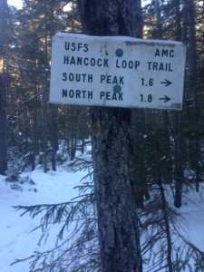
Sign for second junction (Thanks AMC!)
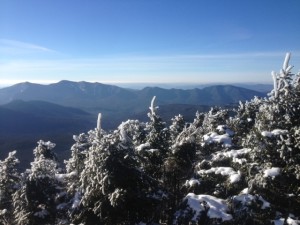
following the sign that says Hancock loop (pictured right). Then proceed another 1.1 miles to a trail split. Up until this trail split all the terrain on the hike is easy and mostly flat. During the time of year I went (early January) you will need microspikes for the ice on the trail and the river crossings. Once at the trail split to begin the Hancock Loop trail you will have the option to go right to South Hancock or left to Mt. Hancock; I chose to go up south Hancock first because the trail to the summit was a little shorter. This trail is quite steep, however once at the top (.5 miles) you can walk about 30 feet to a lookout and get some humbling views. The views will remind you how small you are and that humans don’t rule the whole earth. This southeast view looks out into complete wilderness as far as I could see and there was no sign of human impact in sight (roads, houses etc.). After taking in your view start your journey to the second peak walking the 1.4 mile ridge. This was such a peaceful and easy ridge hike and my favorite part of

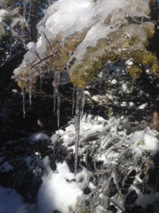
icicles formed that fell to make a pretty sound on their journey to the ground
the hike, partly because of the few, but pretty ridge views. Also the icicles that had formed on the pine needles kept falling off and making a wind chime type of sound, adding more amazement to the adventure. You arrive next at the 3 way intersection at the top of Mt. Hancock, follow the sign to the southwest outlook only about 100 yds away. The views are great, and again you have no sight of
human impact as far as I could see. Next follow the sign that says loop junction (.7 miles) down to the trail split from earlier. This trail is steep so take your time on it. Once you arrive follow the signs and take the trail out the same way you came in. back to the road, which you will cross, up to the parking lot where your car still is (hopefully). CHEERS!
FYI
- The trail starts about 600 feet down and across the road from where you park (Hancock overlook)
- If you are doing this hike in the winter bring microspikes and snowshoes. I didn’t need snowshoes, but bring for good measure especially if there is new snow on the ground.
- The trail is easy and flat for the first 3.6 miles then it becomes very steep.
- There are a couple of small river crossings, nothing deep or major, but be careful on them especially in the cold when there is ice.
- Bring enough food and water for the total 8.6 mile hike. took me about 3.5 hours with a good amount of jogging.
Getting There
Exit 32 off of I-93. Head east on the Kancamagus highway (Rt.12) like you are heading to Loon Mountain. It is about 20 minutes from exit 32 or about 10 minutes (7.5 miles) after you pass Loon Mountain. You will take a very sharp turn before the parking lot, on this sharp turn there is a sign that says parking 600 feet; by this sign is where the trail head begins. Park your car in the Hancock Overlook, walk to the end of the parking lot to where there is a trail, take this down to the road, cross and begin your hike!!
